Municipality of Saint-Barbe
Located in the extreme southwest of Quebec, in the administrative region of the Montérégie, the MRC du Haut-Saint-Laurent was constituted on December 9, 1981 (the date of the decree).
It is bordered on the south by the State of New York; to the north, by the MRC du Beauharnois-Salaberry; to the west, by the St. Lawrence River, the MRC du Vaudreuil-Soulanges, and the province of Ontario; and to the east by the MRC des Jardins-de-Napierville. The territory, with a land area of 1,168 km2, is part of the St. Lawrence Lowlands.
Covey Hill, which is a foothill to the Adirondack Mountains, has its summit at 342 metres above sea level. Several waterways wind through the territory, mainly the Chateauguay River, the English River and Trout River. The MRC can be accessed, coming from Montreal, by Highway 138; from the south-east and east via Route 202 and 209; from the north by way of Salaberry-de-Valleyfield and across the St. Lawrence Seaway via Route 132 and 201, or from New York State by crossing one of four border entry points.
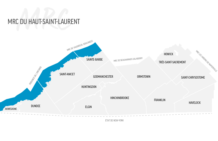
13 Municipalities
23 292 inhabitants
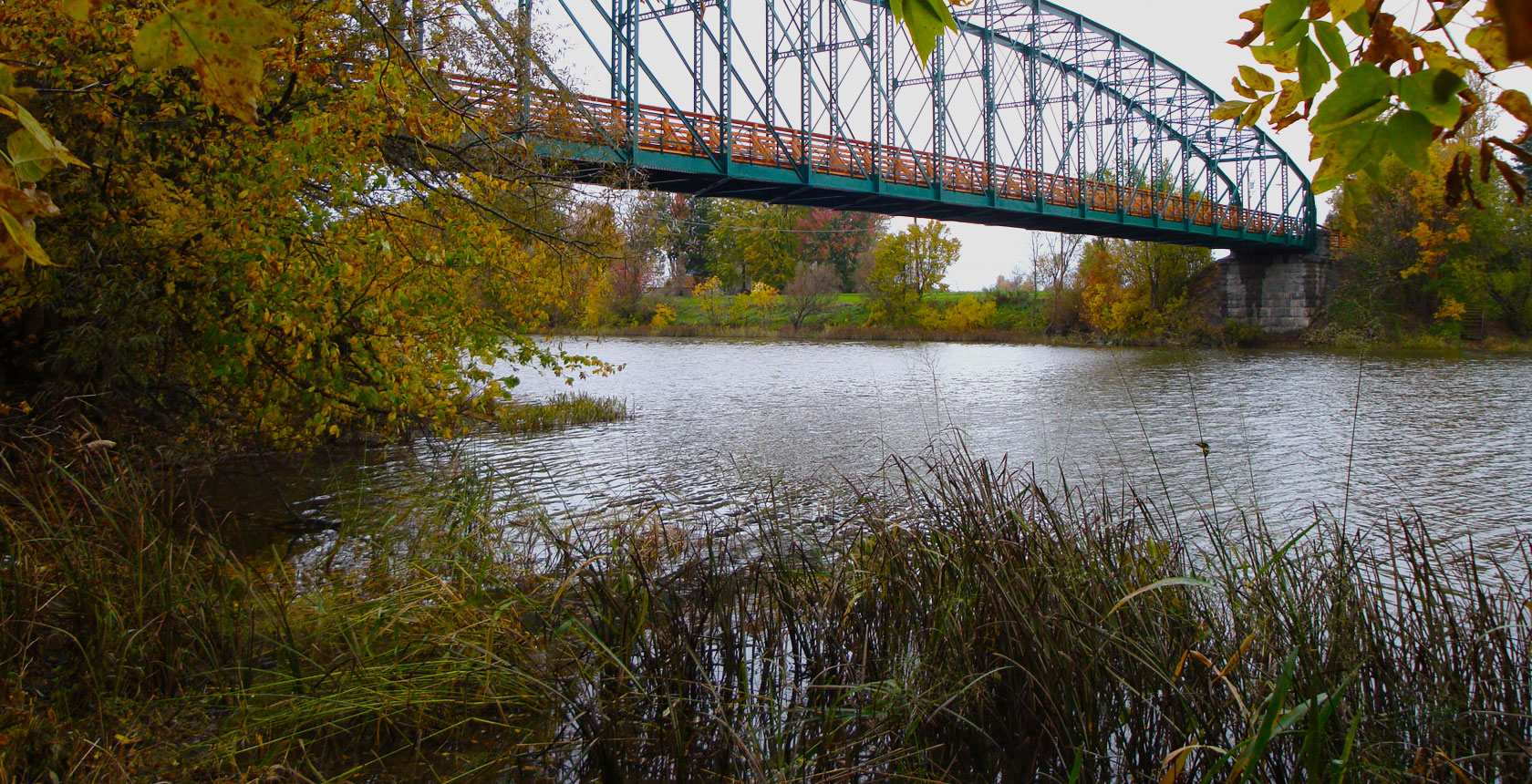
Turcot Bridge, Très-Saint-Sacrement
© MRC du Haut-Saint-Laurent
The MRC consists of thirteen (13) municipalities with different designations, namely the Town of Huntingdon, the Parish of Très-Saint-Sacrement, the townships of Dundee, Godmanchester and Havelock, and the municipalities of Elgin, Franklin, Hinchinbrooke, Howick, Ormstown, Saint-Anicet, Saint-Chrysostome, and Sainte-Barbe. The majority of the population lives in rural or agricultural zones (67%), the urban communities of Huntingdon, Howick, Ormstown and Saint-Chrysostome (24%), and in the vacation region (9%) of Lake Saint-François. There are approximately 23 292 inhabitants* in the MRC du Haut-Saint-Laurent.
*Ministry of Municipal Affairs and Land Occupancy, 2024 decree; source: Institut de la statistique du Québec
93% of the region is zoned agricultural, of which 34% is under forest cover. Agriculture represents 20% of economic activity and employs 13% of the population. The landscape is permeated with corn and soybean crops, livestock farms, market gardens, apple orchards and maple bushes.
The secondary sector (processing) also accounts for 20% of employment, while the tertiary sector (services) employs 54% of the population.
Hamlets, or small concentrations of dwellings, testify to the cultural diversity of the communities that colonized the territory, while ancestral stone houses, centuries-old farms, numerous churches and natural areas, are all elements constituting a well-preserved built and natural heritage that charms visitors and inspires an exceptional living environment.
Land in the agricultural zone
93%
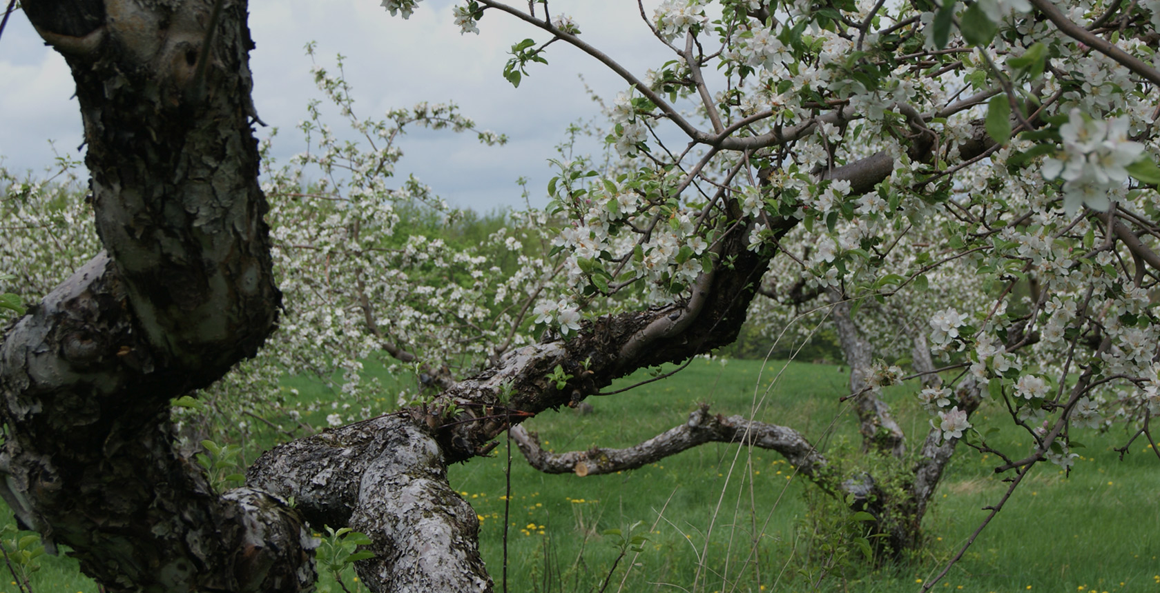
Municipality of Franklin
© MRC du Haut-Saint-Laurent
The Haut-Saint-Laurent is an agrotourism marvel with its numerous orchards, blueberry fields, and sugar bushes, as well as vineyards and artisanal producers (cheese, meats, baked goods and microbreweries). The Lake St-François National Wildlife Area, the Battle of the Chateauguay National Historic Site, the Droulers Archaeological Site and Interpretation Centre, as well as the many churches throughout the region are all places worthy of a visit. Come and discover the cachet of this magnificent yet little-known region of Quebec.
With 14 archaeological sites, three major Iroquoian village settlements – the McDonald, Droulers and Mailhout-Curran sites, and over 800,000 artifacts, the archaeological potential of the Haut-Saint-Laurent is incomparable.
These archaeological deposits cover a significant part of the cultural history of the St. Lawrence Iroquois, ranging from the appearance of agriculture around 1320 with the establishment of small, semi-sedentary communities that erected longhouses on the hillsides along the banks of the La Guerre River, to the arrival of the first European explorers in the mid-16th century AD.
The Droulers-Tsiionhiakwatha Archaeological Site is located on the remains of a village occupied by St. Lawrence Iroquoians during the 15th century, with replica installations serving as an interpretation centre.
In addition, be sure to visit these sections of the site: Municipalities, History of the MRC, Archaeology and Heritage.
ARTIFACTS FOUND IN THE HAUT-SAINT-LAURENT
MORE THAN 800,000
Archeological Portrait of the MRC du Haut-Saint-Laurent